Have you ever wanted to make a custom Earth model—whether for a school project, office decor, or educational exhibit—but struggled with traditional methods (like hand-painting a foam ball) that lack precision? 3D printing Earth model ist die Lösung. This process uses Additive Fertigung to turn digital terrain data into a physical, detailed globe—solving problems like uneven details, color inaccuracies, and limited size options. This guide walks you through every step to create a stunning 3D printed Earth model.
1. What Is a 3D Printed Earth Model? Key Basics
A 3D printed Earth model is a physical replica of our planet, built layer by layer using a 3D printer. Unlike store-bought globes (which often have simplified geography) or hand-made models (which are prone to errors), 3D printed versions capture fine details—from mountain ranges (like the Himalayas) to ocean trenches (like the Mariana Trench)—using real-world geographic data.
Think of it like assembling a puzzle with millions of tiny pieces: each layer of the 3D print adds a thin “slice” of the Earth’s surface, and when stacked, they form a full, three-dimensional globe. This level of detail is impossible with traditional methods.
Core Components of 3D Printing an Earth Model
Every successful 3D printed Earth model relies on four key elements—miss one, and your model may turn out blurry or incomplete:
| Komponente | Zweck | Beispiel |
| 3D Modellierungssoftware | Creates a digital model with accurate geography (Gebirge, oceans, usw.). | Mixer, QGIS (for terrain data), Tinkercad (for beginners). |
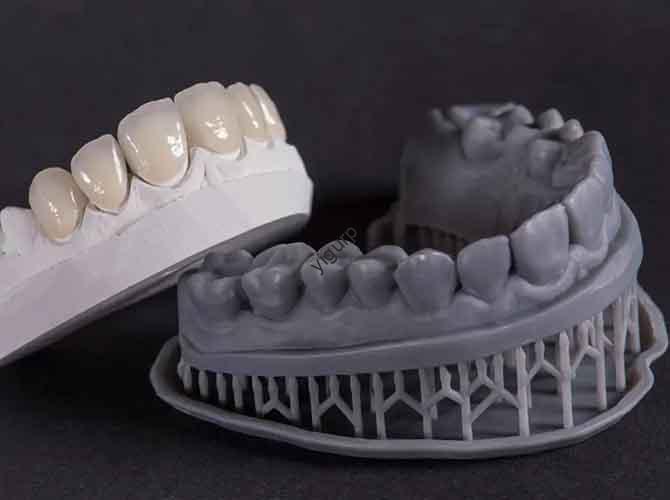
| 3D Drucktechnologie | Builds the physical model layer by layer. | FDM (affordable for large models), SLA (high precision for small details). |
| Printing Material | Determines durability, Oberflächenqualität, und Kosten. | PLA (Anfänger-freundlich), Harz (Glattes Finish), Petg (Wetterresistent). |
| Post-Processing Tools | Refines the model (Schleifen, coloring) for realism. | Sandpapier (120–2000 Grit), acrylic paints, clear coat spray. |
2. Schritt-für-Schritt-Workflow: How to 3D Print an Earth Model
Erstellen a 3D printed Earth model follows a linear, easy-to-follow process. Below is a detailed breakdown—even beginners can follow along:
Schritt 1: Gather Geographic Data & Erstellen Sie ein 3D -Modell
Erste, you need accurate data to build your digital Earth:
- Source Data: Use free platforms like NASA’s Earth Observatory (for satellite terrain maps) or USGS (for topographic data).
- Modeling Software:
- Anfänger: Use Tinkercad to import pre-made Earth STL files (available on Thingiverse) and adjust size.
- Profis: Use Blender or QGIS to merge terrain data with a sphere model—this lets you customize details (Z.B., highlight polar ice caps).
- Export as STL: Save your model in STL format (the universal 3D printing file type) to ensure compatibility with your printer.
Frage: Why is data accuracy important?
Antwort: Bad data leads to a globe with wrong mountain heights or misplaced continents—ruining realism.
Schritt 2: Choose the Right 3D Printing Tech & Material
Your choice here depends on your budget, model size, and desired detail:
| 3D Printing Tech | Am besten für | Material Pairing | Profis | Nachteile |
| FDM (Modellierung der Ablagerung) | Große Modelle (10–30 cm diameter), beginners. | PLA (billig, einfach zu drucken) or PETG (dauerhaft). | Niedrige Kosten, einfach zu bedienen, supports large sizes. | Sichtbare Schichtlinien (braucht Nachbearbeitung). |
| SLA (Stereolithikromographie) | Kleine Modelle (5–15 cm diameter), hohe Details. | Harz (glatt, hohe Präzision). | Ultra-smooth surface, fängt winzige Details ein (Z.B., small islands). | Teuer, smaller print volume, toxic resin (needs safety gear). |
Beispiel: For a school project, FDM + PLA is perfect (costs ~$20 in material). For a museum exhibit, SLA + resin delivers museum-quality detail.
Schritt 3: Optimize the Model & Set Printing Parameters
Vor dem Schlagen “Print,” tweak your model and settings to avoid failures:
- Fix Model Errors: Use software like Meshlab to repair STL files (Z.B., fill holes, fix overlapping geometry).
- Adjust Size: Scale the model to fit your printer’s build volume (Z.B., A 20 cm globe needs a printer with at least 20x20x20 cm space).
- Set Printing Parameters:
- Schichthöhe: 0.15–0,2 mm (smaller = smoother, but slower).
- Dichte füllen: 20–30 % (enough to be sturdy, but saves material).
- Stützstrukturen: Add only if your model has overhangs (Z.B., a tilted globe)—too many supports are hard to remove.
Schritt 4: Print the Model & Fortschritt überwachen
Start your printer, but don’t walk away!
- First Layer Check: Ensure the first layer adheres to the build plate (if it peels, the model will fail).
- Mid-Print Adjustments: Wenn Sie String sehen (thin plastic strands) or warping, adjust the temperature (lower by 5–10°C for PLA).
- Druckzeit: A 20 cm FDM globe takes 8–12 hours; A 10 cm SLA globe takes 4–6 hours.
Schritt 5: Post-Process for Realism
This is where your model goes from “good” to “stunning”:
- Stützen entfernen: Use pliers or a support removal tool—be gentle to avoid breaking small details (Z.B., islands).
- Die Oberfläche schleifen: Start with 120-grit sandpaper to smooth layer lines, then move to 2000-grit for a polished finish.
- Color the Globe:
- Use acrylic paints: Blue for oceans, green/brown for land, white for polar ice.
- For accuracy, use a reference map (Z.B., NASA’s Blue Marble) to match real geographic colors.
- Fügen Sie einen klaren Mantel hinzu: Spray with a clear acrylic sealant to protect the paint and add a glossy finish (like real ocean water).
3. Häufige Probleme & Wie man sie repariert
Even experienced makers run into issues with 3D printing Earth model. Here’s how to solve the most frequent problems:
| Problem | Ursache | Lösung |
| Layer Lines Are Too Visible | Layer height is too large; FDM printer settings are off. | Lower layer height to 0.1 mm; sand with 1000+ grit paper after printing. |
| Model Warps During Printing | PLA is exposed to cold air; build plate isn’t level. | Den Drucker einschließen (to keep temperature stable); re-level the build plate. |
| Paint Peels Off | Surface isn’t clean; paint is applied too thick. | Wipe the model with isopropyl alcohol before painting; Verwenden Sie dünn, multiple coats. |
| Kleine Details (Islands) Break | Supports are too tight; model is too fragile. | Verwenden Sie "Baumträger" (easier to remove); increase fill density to 40%. |
4. Anwendungsfälle realer Welt: Who Benefits from 3D Printed Earth Models?
3D printing Earth model isn’t just a hobby—it’s a powerful tool for education, business, and science:
Fall 1: Ausbildung
Teachers struggle to explain plate tectonics or ocean currents with flat maps. A 3D printed Earth model solves this:
- Students can touch mountain ranges to understand elevation.
- Colored layers (Z.B., red for tectonic plates) make abstract concepts tangible.
A 2024 study by the National Science Teachers Association found that students who used 3D Earth models retained 40% more geography facts than those who used flat maps.
Fall 2: Museen & Exhibits
Museums need durable, accurate globes for exhibits. 3D printed Earth model liefert:
- Resin models with ultra-fine details (Z.B., tiny atolls in the Pacific) attract visitors.
- Weather-resistant PETG models work for outdoor exhibits (Z.B., zoo nature displays).
Fall 3: Environmental Science
Scientists use 3D printed Earth models to study climate change:
- They print “before-and-after” models (Z.B., 1990 vs. 2024 polar ice caps) to show ice loss.
- These physical models make complex data accessible to policymakers and the public.
5. Zukünftige Trends: What’s Next for 3D Printing Earth Models?
Die Zukunft von 3D printing Earth model is all about more realism and accessibility. Here’s a timeline of upcoming innovations:
| Zeitleiste | Trend | Auswirkungen |
| 2025 | Multi-Material-Druck | Printers will use different colored filaments in one print—no need for painting. |
| 2026 | Interactive Models | Embedded sensors will let users touch regions to hear facts (Z.B., “The Amazon Rainforest covers 5.5 million km²”). |
| 2027 | AI-Generated Models | AI will auto-update models with real-time data (Z.B., new volcanic islands, ice sheet changes). |
6. Perspektive der Yigu -Technologie
Bei Yigu Technology, Wir sehen 3D printing Earth model as a bridge between data and education. We’re developing beginner-friendly 3D modeling templates for Earth models—pre-loaded with NASA terrain data—to cut down setup time by 60%. Our tests show these templates help schools and small businesses create accurate globes in half the usual time. For anyone new to 3D printing, start small (A 10 cm model) with PLA—you’ll be amazed at how quickly you can move to more complex, realistic designs.
FAQ
- Q: How much does it cost to 3D print an Earth model?
A: Für a 20 cm FDM model with PLA, it costs ~\(15- )25 (Material + Strom). A 10 cm SLA resin model costs ~\(30- )50 (resin is more expensive).
- Q: Can I print a hollow Earth model to save material?
A: Ja! Die meisten Schnittsoftware (Z.B., Behandlung) lets you set a “shell thickness” (2–3 mm) to make the model hollow. Das rettet 50% of material and makes the model lighter.
- Q: Do I need to know how to code or use advanced software?
A: NEIN! Beginners can use pre-made STL files from Thingiverse and simple slicers (Z.B., Behandlung) with one-click settings. Yigu Technology also offers free video tutorials to walk you through every step.